Below are a few suggested hikes with approximate distances. Each section heading has a generalized map showing the trail routes. Please consult the KVR visitor guide for more details and information. Please note that there are not bridges at the trail crossings of Warner, nor Weister. Stream fords on trails are generally shallow and many are too wide to jump across. Stream Fords are noted on the KVR Map. While using a KVR Trail Map it is good to note that trail intersections are marked with numbers. These numbers on the map correspond with numbers on the trail markers also called carsonites and act as "You are here" points.
HIKES TO HANSON ROCK
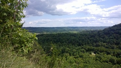
Hanson Rock from Corps Road (8 miles round-trip).
Start from the maintenance building off of Corps Road. Follow the West Ridge Trail (snowmobile trail) westward. The trail begins in grassy open areas through prairie plantings, eventually entering the woods. Follow the trail as it winds through forested areas. The trail descends into Hanson Hollow near Campsite F. Find the horse trail (Hanson Rock Trail) once you enter a stand of red pines on your left. Follow the horse trail up to the ridge top (about 500 feet of elevation gain). At trail junction #4, turn left on the Hanson Rock Loop for a great overlook. After the loop, continue along Hanson Rock as it follows the ridge line, providing additional overlooks. These overlooks are on short spurs off the main trail (they can be missed if not looking for them). Continue along the trail as it descends off the ridge returning to the West Ridge Trail at intersection #2. Turn right (south) on the snowmobile trail to return to the maintenance building.
KVR Trail Challenge segments accomplished by this hike are: 18, 23, 25.
Hanson Rock from Potts Corner/Campsite P (6.5 miles round-trip)
Start on the multi-use West Ridge Trail (snowmobile trail) near Campsite P on Weister Creek Road. Follow the trail to the Hanson Rock Trail at intersection #2. Follow Hanson Rock up to the ridge for scenic overlooks. At intersection #4, continue straight on to Hanson Rock Loop to an additional overlook. Upon returning to #4, head down the right slope to Hanson's Hollow campsite F. Upon meeting the West Ridge Trail, turn left, pass along the river, and continue until returning to campsite P.
KVR Trail Challenge segments accomplished by this hike are: 21, 22, 23, 24, 25
Hanson Rock from County P Gate (7 miles round-trip)
Start at the Old 131 gate on County Hwy P. Head south on Old 131 and find the Little Canada Trail. Continue to intersection #6. Keep towards the right direction to the West Ridge Trail. Follow West Ridge towards the right, walking along the ridge line to intersection #2. Turn left on the Hanson Rock Trail. Follow said trail up to the ridge and overlooks. At intersection #4, continue straight onto Hanson Rock Loop for additional overlooks. Upon returning to #4, head down the right slope to Hanson's Hollow campsite F on the West Ridge Trail. Upon meeting West Ridge, turn left, pass along river, and continue until intersection #5 at the Ice Cave Trail. Follow this to intersection #6 and turn right onto Little Canada and back to Old 131.
KVR Trail Challenge segments accomplished by this hike are: 9, 18, 20, 23, 24, 25, 26, 27, 28
LITTLE CANADA - WEISTER CREEK WOODS
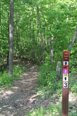
Old 131 Trail - Little Canada - West Ridge- Ice Cave Trails (4 miles round-trip)
Start at the gate at County Highway P and the Old 131 Trail. Head south on Old 131 across Bridge 15. Turn west/right on the Little Canada Trail. Follow the trail up to intersection #6. Heading to the right, continue upward to the West Ridge Trail (snowmobile trail). Turn to the south/left and follow West Ridge down the slope, eventually reaching the semi-open valley bottom as the trail becomes grassy. Look for the Ice Cave Trail on the north/left (if the West Ridge Trail makes a right turn, you have passed the Ice Cave Trail). Follow Ice Cave upward to a wooded overlook of the Kickapoo River. The next deep and narrow valley has a rock shelter at its head; search for it. Continue on the trail until you return to intersection #6 at Little Canada. Continue to the right to return down Little Canada to Old 131. Of course, the loop can be followed in the opposite direction.
KVR Trail Challenge segments accomplished by this hike are: 9, 19, 26, 27, 28.
West Ridge Trail to Ma and Pa’s Trails, County Highway P (3 miles round-trip)
This loop includes about one mile of walking along County Hwy P.
Start at Campsite P. Follow the West Ridge Trail (snowmobile trail) to Ma and Pa’s Trail on the left side of the trail. Follow through the woods and down a gradual descent, eventually coming to Weister Creek (here you have completed two miles of the loop). You can either get your feet wet and cross the creek (DO NOT ATTEMPT TO CROSS DURING HIGH WATER), or return via the route you came. If you decide to cross the creek, follow the trail on the opposite side to campsite O and take County Hwy P to the left, leading you to Weister Creek Road and back to campsite P. Of course, the route can be taken in the opposite direction.
KVR Trail Challenge segments accomplished by this hike are: 22 & 29.
HAY VALLEY WOODS
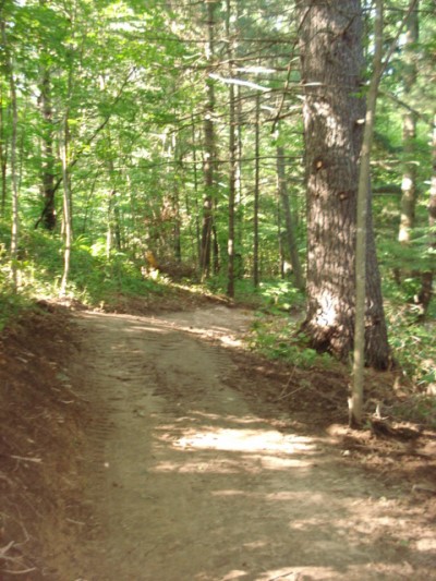
Campsite U/ Hay Valley Trail to Washout Trail (3 miles round-trip)
Start at campsite U on Hay Valley Road. Follow the trail across the bridge and over Hay Creek. The trail splits, so be sure to continue straight/left. The trail makes a long ascent though pines and into mixed hardwoods. At the top, the trail is relatively flat for a short while before beginning a descent. Continue to the head of two valleys, both creating left turns. After the second valley, look for a stone foundation on the north/left side of the trail. Rumor has it, this was a honey shack back in the day.
Continue on the trail until you reach intersection #10. A short connecting trail leads to the Washout/Bailout Trail, doubling as the snowmobile trail come winter; turning right takes you to State Highway 131. Turn left, heading down the slope. Continue following Washout/the snowmobile trail up a short steep hill, through an small open area, up a long hill, down the other side, and left across an open area until you return to the Hay Valley Trail. A short walk to the north brings you back to campsite U.
KVR Trail Challenge segments accomplished by this hike are: 32 & 35.
Bailout Trail to Washout and Hay Valley Trails (4 miles round-trip)
Park along State Highway 131 at a gravel field access on the west side of the road, south of Winchell Valley Road. Walk up the access to find the trail, leading you along the edge of an agriculture field into the woods. Follow the wide trail up a gentle slope until you reach a trail intersection. Continue following the snowmobile trail, now called Washout, keeping right as you head down the slope. Continue up a short steep hill, through a small open area, up a long hill, down the other side, and then left to cross the open until you come to the Hay Valley Trail. Here, turn to the left; to the right will take you to campsite U/Hay Valley Road.
The Hay Valley Trail begins a long ascent though pines and mixed hardwoods. At the top, the trail is relatively flat for a short while before it begins a descent. Continue to the head of two valleys, both creating left bends/turns. After the second valley, look for a stone foundation on the north/left side of the trail. Rumor has it; this was a honey shack back in the day.
Continue on the trail until you reach intersection #10. A short connecting trail leading to the left takes you to the Washout/Bailout Trail. Once back to Bailout, turn right and return to State Highway 131.
KVR Trail Challenge segments accomplished by this hike are: 32, 35, 51.
HIKES FROM THE VISITOR CENTER
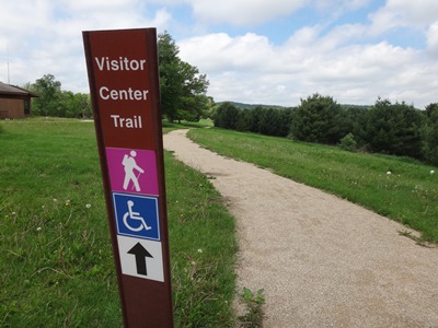
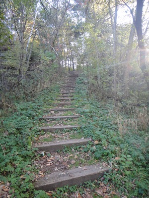
Visitor Center Trails (1.5 miles round-trip)
This short hike is considered to be a part of the visitor center, so no trail pass is required. Start from KVR visitor center. Follow the Visitor Center Trail either from the north side of the building or from the deck. The trail makes a loop. At the far west end, find a trail near the large pine trees that leads you down railroad tie steps to the river bottom. Cross a small foot bridge to reach the Pond Trail. At the intersection, turn west/left to reach the Old 131 Trail. A short walk to the south will bring you to Bridge 18 for a view of the Kickapoo River. Walk north on Old 131 to campsite A (on your west/left) and the Old Harris Road Trail (on your east/right). A bird blind is located at the far end of campsite A for wildlife viewing. Follow the Old Harris Road trail back to the visitor center parking lot.
KVR Trail Challenge segments accomplished by this hike are: 1, 2, 3.

Wintergreen Bluff Trail (1.5 miles round-trip)
Find the trail head near the east of the visitor center by the garage/bathroom kiosk area. Situated between State Highway 131 and the Kickapoo River, the trail leads through mixed hardwoods and conifer stands. Several views of the river exist along the route. The trail will descend upon a series of rock ledges, which were cut during the dam project. A steep climb up stone steps leads to an intersection. Follow the trail towards the right through a stand of pines and hemlocks along a narrow ridge. At the trail end is an overlook of the Kickapoo River. For the return trip, head back through the pines/hemlocks. At the intersection, one can head to the right to come out on State Highway 131 and follow the shoulder back to the visitor center. Otherwise, return along the trail as you came, which is a much more scenic route than the highway.
KVR Trail Challenge segments accomplished by this hike are: 4
COUNTY HWY P-EAST
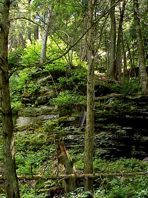
Cut Off Road Trail to Big Valley Trail to 9-10 Trail (5 miles)
There are several starting points for this loop, such as Big Valley Road or Landing 10. Here, we will start at the trail head on Cut Off Road. From County Highway P, turn south on Cut Off Road, cross a small bridge, and look for trail on left about 300 feet from the bridge. The trail leads along the edge of a wetland and many rock ledges, followed by a gradually climb in to a hardwood forest. A small opening is at the top of the ascent before heading back into the woods. Continue until you come to intersection #8, keeping left through another open stretch. You then come to County Highway P. Cross the road and head right/east to Big Valley Road. A short walk along Big Valley Road leads across Warner Creek; you should look for your trail on the left. Follow this trail for 2.5 miles, eventually coming to State Highway 131. Cross the highway and head north/right a short bit to find the 9-10 Trail (snowmobile trail) along the south/left side of a field. Follow this through the woods until you come to State Highway 131 again at bridge 10. Cross the highway and head east on County Highway P for about 0.5 miles until you reach Cut Off Road, where you will turn right and return to the start of your hike.
KVR Trail Challenge segments accomplished by this hike are: 40, 44.
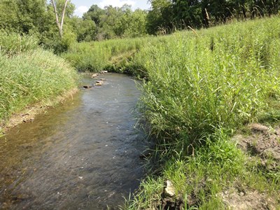
Hoot Owl Trail (3-mile loop)
Park on Big Valley Road. Follow Big Valley Road to County Highway P and cross the highway. Turn right and look for a trail on the left/south side of the road. Follow through an open stretch until reaching intersection #8, where you turn left. Follow through the woods and across a small creek until the trail comes to Haugh Road. Turn left and walk Haugh Road for 0.2 miles to County Highway P. There, cross and look for the trail at the field edge on your left. Follow this around the field edge to Warner Creek. Unless you can jump great distances, your feet will need to get wet here (alternate route is listed below). Cross the creek and continue along the trail though fallow fields, woods, and a small stream crossing. When you come to Scratch Avenue, cross the road to continue on your trail. Follow this segment to Big Valley Road. Turn left at the road and find your vehicle.
KVR Trail Challenge segments accomplished by this hike are: 41, 42, 43.
**To avoid the Warner Creek crossing.... from Haugh Rd, turn left on CTH P and then turn right on Scratch Ave. Head up the hill and look for the trail on left side of the road.